AC WPP Implementation – Los Fresnos BMPs Implementation
Arroyo Colorado Watershed Protection Plan (WPP) Implementation – Los Fresnos Best Management Practices (BMPs) Implementation supports the implementation of the Arroyo Colorado Watershed Protection Plan, addresses management measures within the tidal segment of the Arroyo Colorado watershed. This project is funded by the Texas Commission on Environmental Quality as part of a Clean Water Act Section 319(h) Grant from the U.S. Environmental Protection Agency.
Project Overview

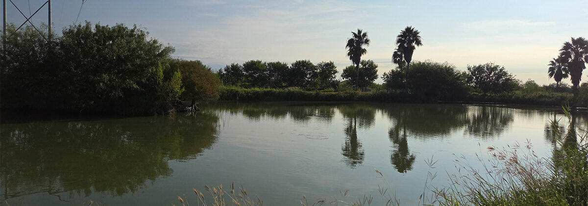
This project, which supports the implementation of the Arroyo Colorado Watershed Protection Plan, addresses management measures within the tidal segment of the Arroyo Colorado watershed. Two coastal sites within the Arroyo Colorado watershed are implementing selected low impact development (LID) improvements: the City of Los Fresnos Nature Park and the Los Fresnos Independent School District High School student parking lot. This project is combining resources from communities, universities and other stakeholders to build a sustainable stormwater drainage program for other Texas coastal communities to follow.
Los Fresnos is developing the 20-acre nature park immediately south of the Los Fresnos High School, with funding in part from the Texas Parks and Wildlife Department, on land purchased with Coastal Impact Assistance Program funds. The LID elements include pervious sections added to a parking lot, bioswales, and a rainwater collection system from the roof of the restroom building. Educational components are also being developed. High school classes will use the park as an outdoor classroom for a variety of natural sciences and natural resource-based classwork.
The Los Fresnos High School parking lot is being modified to allow stormwater to be drained to existing vegetated areas and an isolated detention wetland. The parking lot has been refurbished to reduce erosion and sediment in the stormwater, including adding native trees to capture and detain stormwater and re-grading vegetated filter strips at the curb cuts.
Los Fresnos science students perform Citizen Water Quality Monitoring in the parking lot, with water testing kits and training. The high school will incorporate this experiential learning into their Science, Technology, Engineering, and Math (STEM) curricula.
Arroyo Colorado Watershed Coordinator is coordinating education and outreach efforts and support ting partner communication and cooperation, public awareness and understanding, student monitoring training, and communication with public officials.
Coastal Zone Pesticide Education
Background
The Arroyo Colorado is an ancient channel of the Rio Grande River that extends eastward for about 90 miles from near the City of Mission through southern Hidalgo County to the City of Harlingen in Cameron County, eventually discharging into the Laguna Madre near the Cameron-Willacy County line. The tidal segment of the Arroyo Colorado, as classified by the Texas Commission on Environmental Quality, is between the confluence with Laguna Madre in Cameron/Willacy County to a point 100 meters (110 yards) downstream of Cemetery Road south of Port Harlingen in Cameron County. This part of the river is also defined as a coastal natural resource area (CNRA) and a coastal wetland in the Coastal Coordination Act.
Water quality monitoring over the past decade has confirmed low oxygen levels, as well as escalated ammonia and nitrate concentrations, that have contributed to multiple fish kills in the tidal segment. These sub-optimal aquatic conditions resulted in this portion of the Arroyo Colorado being placed on the 303(d) list for high aquatic life use impairment in 2002. Numerous urban sources, such as point source wastewater discharges, have contributed to this impairment; however, according to the Arroyo Colorado Watershed Protection Plan, nonpoint source agricultural runoff accounts for much of the water quality issues in the tidal segment.
These coastal issues and other water quality issues in the watershed have been addressed by the more than 500-member Arroyo Colorado Watershed Partnership in the Arroyo Colorado Water Protection Plan (ACWPP). That plan identifies needs specific to water quality protection and improvement for the agricultural community as well as addressing nonpoint source pollution from the urban environment such as landscapes . Therefore, Texas Water Resources Institute (TWRI) proposes to work through the Texas AgriLife Extension Service (Extension) to implement an educational program for agricultural producers including turfgrass producers as well as those managing athletic fields such as school district personnel. The agricultural effort will be an integrated farm management program focused on pesticide education and proper nutrient management for Cameron and Willacy Counties to address water quality issues related to agricultural production in the tidal segment of the Arroyo Colorado. While the turfgrass community will also be invited to the education programs provided through the agricultural effort, a targeted educational conference will be held for turf producers and managers to better their skills at nutrient, pesticide and irrigation management to reduce the potential for nonpoint source pollution.
Goals
This education plan will help fulfill two of the goals of the Texas Coastal Management Program. First, agricultural and turfgrass producers and managers in Cameron and Willacy County will be educated on water quality issues and how the proper application of pesticides meets current laws and regulations and can improve the water quality and fish community in the Arroyo CNRA. Second, utilization of proper pesticide application practices by producers and managers will reduce the potential for nonpoint source pollution, which will improve the water quality in the Arroyo CNRA and enhance the ability of this area to continue to support valuable aquatic life and meet water quality goals outlined in the ACWPP. An additional benefit not associated with the Coastal Management Program, but still an environmental success for this area given the over-allocation and availability of clean surface waters will be the added water savings attributed to the irrigation management education program provided through this effort.
Objectives
The overall objective of this project is to implement components of an integrated farm management program to educate agricultural and turfgrass producers about laws and regulations and on how to better manage their land through safe use of crop protection chemicals, nutrients and irrigation and in doing so, reduce the potential for nonpoint source pollution. Extension will utilize its already developed resources and delivery system to enhance their programs and educate producers on pesticide laws, use regulations, and management and application techniques. The Pesticide Applicator Safety Training and Continuing Education program will address the following topics: principles of integrated pest management, non-chemical alternatives, pest features, ground and surface water protection, laws and regulations, pesticide labels, endangered species protection, Worker Protection Standards, record keeping, personal protection, application equipment, and calibration. The Sports Athletic Field Education Program addresses the following principles: effective and economic nutrient applications; reduced pesticide management techniques including proper soil and plant management; maintained turf health for proper playing surface; reduced water use and efficient irrigation management; and continued support for program implementation to ensure sustained success of the program.
TWRI and Extension will host educational meetings and produce educational materials for producers on the importance of proper pesticide application and use of integrated pest management practices to protect water quality in Cameron County as they implement the Arroyo Colorado Watershed Protection Plan. Funds to support the development and delivery of the educational programs will be provided by the EPA Strategic Agricultural Initiative Program. In addition, the EPA program will cover the delivery of an IPM and Best Management Practice (BMP) Newsletter and a fact sheet directed at implementing BMPs for proper natural resources management. TWRI and Extension will document project participation at all events and meetings. Programs will have pre and post assessment surveys where knowledge gained can be gauged. Follow-up surveys will be used to quantify implementation of BMPs. Overall success will be measured by the number of individual producers the project reaches and estimates of BMP implementation.
Under this program, TWRI and Extension will supplement the agricultural educational programs and field days with outreach materials that address specific practices to reduce the potential for nonpoint source pollution from pesticides, nutrients, irrigation and sediment. These materials will encourage the adoption and implementation of proper integrated pest management practices. For example, signs will be distributed to growers to use on-farm to designate areas of pesticide mixing, clean-out and the proper disposal of used pesticide containers. Additionally, growers can participate in soil-testing campaigns to encourage proper nutrient applications. Finally, a fact sheet will be produced that can be used outside of the Arroyo Colorado Watershed to address water quality issues in other coastal areas impacted by agricultural nonpoint source pollution.
A targeted turfgrass educational program will also be included in this program. Extension will couple the already successful Sports Athletic Field Education (SAFE) Program with its resources for turfgrass producers to present proper management techniques through an educational conference, hands-on learning techniques, soil-testing campaigns to encourage proper nutrient applications, and on-site visits to ensure proper implementation of the suggested practices. The SAFE Program offers turf management assistance for sports field maintenance personnel and many turfgrass producers operate within the Arroyo Colorado floodplain. Thus, a program targeting both turfgrass managers and producers has great potential to reduce nonpoint source pollution to the Arroyo Colorado.
Measures of Success
The overall impact of this project will be that it will provide landowners with accurate technically sound information that they can utilize to reduce the potential for nonpoint source pollution caused by improper use of land management techniques and to maintain and improve water quality in the Arroyo Colorado Watershed. TWRI and Extension will document project participation at all events and meetings. Education programs will have a pre and post assessment survey where knowledge learned can be gauged. Overall success will be measured by the number of individual producers the project reaches.
Funding Source
Funding provided by General Land Office as part of the Coastal Management Program.
Integrated Farm Management
Background
The Lower Rio Grande Valley is one of the fastest growing regions in the nation and this trend is a blatant reminder of the crisis facing our agricultural industry as it strives to produce healthy, low-cost food for our nation while protecting and conserving our natural resources and environment. Even with this rapidly growing urban population (more than 10 cities with populations over 10,000) though, the Lower Rio Grande Valley is also a leading agricultural area in Texas and produces a cornucopia of commodities including sugar cane, corn, cotton, grain sorghum, citrus (orange, grapefruit, tangerine, lemon, lime, tangelo), cantaloupes, honeydew melons and numerous vegetable crops (cabbage, onions, carrots, peppers, broccoli). The Arroyo Colorado, which provides drainage for much of this area, is a primary habitat and nursery for numerous species of marine fish, shrimp and crab and is the primary freshwater source for the Lower Laguna Madre, which supports major fish and bird populations and provide jobs and recreational opportunities that bring millions of dollars form tourism and commercial fishing to South Texas. Thus, the agricultural, economic and environmental health of the Valley is closely tied to the health of the Arroyo Colorado.
To protect the health of the Arroyo Colorado, the Texas AgriLife Extension Service proposes to implement an innovative education program for agricultural producers focusing on integrated farm management systems (whole system approach). This program, administered by the Texas Water Resources Institute, will meet three of the six goals identified by the EPA Region 6 SAI Program. Extension will host educational meetings and produce educational materials on the adoption of: proper pesticide application safety practices; an integrated farm management system approach; and water quality management plans and cost-share programs to implement management practices. These programs will be highlighted and publicized in an IPM newsletter, which will encourage the adoption of IPM, nutrient, irrigation or production practices. The agricultural diversity and current water quality issues facing this area confirms the need for this integrated education program.
Narrative/Workplan
This integrated farm management education program will meet three of the six goals identified by the Strategic Agricultural Initiative Program. First, Extension will utilize demonstration projects, outreach, and education programs to increase the adoption of reduced risk/IPM practices that provide alternatives to the use of highly toxic pesticides. Second, through these education programs, Extension will encourage partnerships between the producers and local and state government agencies (TSSWCB and local Soil and Water Conservation Districts) in the implementation of water quality management plans and best management practices that utilize reduced risk/IPM practices in the field. Finally, whole-farm management systems (nutrients, pesticides, water and production) will be taught and producers will be encouraged to adopt an integrated farm management approach.
To meet these goals and the specific project objectives, Extension and the Texas Water Resources Institute (TWRI) will collaborate on the following tasks (Task 1 and Task 2) over a two year period.
TWRI will administer the project (subtask 1.1), ensure responsible use of fiscal resources (subtask 1.2), facilitate regular communication (subtask 1.3) and maintain an accurate record of project activities and status and communicate this to EPA Region 6 (subtask 1.4). Extension will utilize its already developed resources and delivery system to enhance their programs to host educational meetings and produce educational materials for producers on the: adoption of proper pesticide application safety practices (subtask 2.1); adoption of an integrated farm management system approach including the proper use and implementation of IPM, nutrient, irrigation and production practices (subtask 2.2); and adoption of water quality management plans and cost-share programs to implement management practices (subtask 2.3). Extension will also produce and distribute an IPM newsletter to encourage the adoption of practices and educate producers about their integrated farm management systems (subtask 2.4). Extension will document project participation at all events and meetings. Selected programs will have pre and post assessment surveys or knowledge assessment surveys that will be used to quantify implementation of BMPs or the intent of the producers to adopt IPM, nutrient, irrigation or production practices.
Objectives
- Enhance awareness of pesticide related water quality issues facing the Lower Rio Grande Valley and encourage producers to use lower risk pesticides in production practices.
- Implement an integrated pest management (IPM) education program through education programs, newsletters and fact sheets.
- Encourage producers to adopt an integrated farm management system (‘whole system’ approach) including pesticide, nutrient, irrigation and production management practices.
- Develop partnerships between Texas AgriLife Extension and local Soil and Water Conservation Districts to encourage growers to implement best management practices and adopt management plans to protect water quality.
Measures of Success
SAI Program Outcomes to be Achieved:
- Increase the number of growers using reduced risk/IPM tools and techniques. Estimates of growers impacted by educational programs will be determined through program surveys.
- Measure qualitative reduction in use of higher risk pesticides or pesticides in general. Estimates of IPM practices adopted and thus, reduced use of pesticides, will be determined through program surveys.
- Encourage partnerships between crop producers, TSSWCB, NRCS and local Soil and Water Conservation Districts to implement reduced risk/IPM programs. Success of partnerships will be based on number of water quality management plans implemented.
- Measure change in level of pest management based on the SAI Transition Gradient. Extension will provide a post program estimate of the SAI Transition Gradient within the final report.
SAI Program Outputs Expected:
- Educational and outreach materials for growers. One fact sheet and one newsletter will be produced and distributed each year. Specific details in subtask 2.4.
- Conferences, seminars, and on-site field training. Multiple education programs addressing benefits and adoption of an integrated farm management system will be held. Specific details on programs can be found in subtask 2.1, 2.2 and 2.3.
- Partnerships established between federal and non-federal programs to provide reduced risk/IPM programs for crop producers. Success of partnerships will be based on number of water quality management plans implemented.
Funding Source
Funding provided by U.S. Environmental Protection Agency as part of the Strategic Agricultural Initiative Program.
Agricultural Nonpoint Source Assessment
Background
The Arroyo Colorado flows through Hidalgo, Cameron and Willacy Counties in the Lower Rio Grande Valley of Texas into the Laguna Madre (Figure 1). Flow in the Arroyo Colorado is sustained by wastewater discharges, agricultural irrigation return flows, urban runoff, and base flows from shallow groundwater. The Arroyo is the major source of fresh water to the lower Laguna Madre, an economically and ecologically important resource to the region. The Laguna Atascosa National Wildlife Refuge and several county and city parks are located within the Arroyo watershed. The mild climate, semi-tropical plants and animals, and many recreational opportunities draw large numbers of people to the Arroyo Colorado watershed. One third of the stream is also used for shipping from the Gulf Intracoastal Waterway to the Port of Harlingen.
As a result of low dissolved oxygen levels, the tidal segment of the Arroyo Colorado (2201), does not currently meet the aquatic life use designated by the State of Texas and described in the Water Quality Standards. This has been the case for every 303(d) list prepared by the state since 1986. There have also been concerns for high nutrient levels in this river as documented on every 305(b) assessment prepared by the state since 1988. In order to meet the dissolved oxygen criteria (24-hour average of 4.0 mg/L and minimum of 3.0 mg/L) at least 90% of the time between the critical period of March through October, TCEQ (2003) estimates a 90% reduction in nitrogen, phosphorous, oxygen demanding substances and sediment will be necessary.
In response to this impairment, a local effort has been initiated to develop a watershed protection plan (WPP) to improve conditions in the Arroyo Colorado. Working with the TCEQ, the TSSWCB, and other agencies, a local steering committee will devise and implement strategies to increase dissolved oxygen in the Arroyo and improve its environmental condition.
The Arroyo Colorado Watershed Steering Committee has established several work groups to address the six major components of the watershed plan: wastewater infrastructure; agricultural issues; habitat restoration; refinement of the TMDL analysis; land use; and public education. The project has significant financial support from federal nonpoint source grants under CWA Section 319(h). Already, the stakeholders have made great progress. The Education and Outreach Work Group has developed an outstanding multimedia presentation about pollution problems in the Arroyo and how to get involved in addressing them. In May 2004, the TCEQ and the Habitat Restoration Work Group established contracts with Texas A&M’s Sea Grant program and the Texas Parks and Wildlife Department to provide an independent watershed coordinator and a habitat restoration specialist to assist in the development of the WPP. TPWD has contracted with Alan Plummer Associates, Inc. to develop a habitat restoration feasibility study. Funding for this study was obtained from NOAA through GLO. A Draft Wastewater Infrastructure plan has been developed. In September 2005, the TSSWCB and the Agricultural Issues Work Group established contracts with (1) Hidalgo and Southmost SWCDs to provide technical and financial assistance to landowners to aid in the development and implementation of WQMPs and (2) the Texas Water Resources Institute and Texas AgriLife Extension Service to provide education on best management practices. The Draft WPP is expected to be completed February 2006.
Goals and Objectives
The primary focus of this 319(h) project is to better characterize agricultural runoff in the Arroyo Colorado, assess and demonstrate the effects of BMP implementation at the field and sub-watershed level, and measure progress towards meeting WPP goals. A secondary focus is to evaluate the natural phosphorus reduction capabilities of drainage ditches on runoff from irrigated cropland in the Arroyo Colorado watershed.
This project will provide storm and routine monitoring of drainage ditches that contribute nonpoint source loadings to the Arroyo Colorado in order to better assess agricultural NPS loadings and reductions resulting from BMP implementation. Monitoring will primarily be directed at evaluating areas with significant irrigated cropland acreage to evaluate nonpoint source pollution (NPS) contributions and determine NPS reductions resulting from BMPs.
A final report will be developed assessing the effects of the conservation practices. Soil sampling and water quality monitoring will be utilized to gauge the impacts on water quality.
This project will be consistent with the Watershed Protection Plan and highly coordinated with the Arroyo Partnership and Arroyo Ag Steering Committee as well as the educational and implementation projects already underway in the watershed. These groups and projects will provide for a great deal of public participation and many opportunities for public input.
In this project, TAMUK and TAES will provide assessment activities at 4 sub-watershed sites within the Arroyo Colorado:
- Mile 4 North FM 491 in Hidalgo County (Lat. 26 06 47.8758, Long -97 53 27.8602)
- +/- 3 miles north of the intersection of US Military Highway 281 and 493 in Hidalgo County (Lat. 26 06 44.6665, Long -98 02 14.987)
- Harding Ranch Road approximately 3 miles north of 508 and 1420 in Cameron County (Lat.26 16 47, Long 97 43 27)
- ABD Road and FM 1479 about 4 miles south of Highway 83 in Cameron County (Lat. 26 08 06 Long 97 43 27)
The monitoring effort will make use of numerous automated sampling systems in TAMUK’s possession that will be made available to this project. Historical or nondirect data obtained from other projects with QAPPs approved by EPA or the State of Texas will also be used to supplement this project. The data collected for this project will be used to determine the reduction of NPS pollution associated with implementation efforts and provide data to inform TSSWCB of areas where focused reduction efforts are most needed. This project will also support the educational efforts in the watershed.
The four sub-watersheds chosen for this study represent predominately irrigated cropland within the Arroyo watershed with two sites being located in Cameron County and two sites in Hidalgo County. The two stream sites in Cameron County were monitored from 2000 to 2002. The historical water quality data available at these sites will be made available as non-direct data to this project for use in the assessment of water quality.
The sub-watershed monitoring activities of this project will consist of automated stormwater sampling, monthly ambient grab sampling, and instantaneous streamflow measurements. Field measurements of dissolved oxygen, water temperature, specific conductance, and pH will occur with all grab sampling. Stormwater samples will be retrieved on a daily basis during storm events and flow composited into a single sample. All water samples will be analyzed for various nutrient forms (i.e., total phosphorus, dissolved orthophosphate phosphorus [frequently referred to as soluble reactive phosphorus], total Kjeldahl nitrogen, dissolved ammonia, dissolved nitrite plus nitrate), and total suspended sediments (TSS). In addition, monthly grab samples will be analyzed for BOD5. The nitrogen forms are included in the laboratory analyses to provide a more complete indication of macronutrient conditions in the watershed, to evaluate whether agricultural BMPs are reducing both nutrients (nitrogen and phosphorus), and to ensure that efforts to reduce one nutrient is not inadvertently increasing another.
This project will provide result demonstrations to landowners in the Arroyo Colorado watershed. This edge of field monitoring will represent both tiled and non-tiled irrigated cropland fields that drain to both drainage ditches and directly into the Arroyo. Surface runoff, along with outflow from the tile drainage system, will be monitored. Surface runoff and tile drain samples will be retrieved on an event basis and flow composited into a single sample. All water samples will be analyzed for various nutrient forms (i.e., total phosphorus, dissolved orthophosphate phosphorus [frequently referred to as soluble reactive phosphorus], total Kjeldahl nitrogen, dissolved ammonia, dissolved nitrite plus nitrate), and total suspended sediments (TSS). In addition, monthly grab samples will be analyzed for BOD5.
This project is dependent upon and is an important component of the larger project effort in the Arroyo Colorado described above. It is closely linked to the CWA §319 funded FY05 Arroyo BMP Education Project being conducted by TWRI and AgriLife Extension, the FY05 Arroyo WQMP Implementation Project being conducted by the TSSWCB and Hidalgo and Southmost SWCDs, and the Arroyo Watershed Coordination Project being conducted by TCEQ and Texas Sea Grant. The results of this study will be used to support ongoing educational and implementation efforts and future modeling efforts planned for the watershed.
Funding Source
Funding provided by the Texas State Soil and Water Conservation Board as part of a Clean Water Act Section 319(h) Grant.
- Final Report
- SWAT Modeling of the Arroyo Colorado Watershed — TR-426
- A Multivariate Water Quality Investigation of Select Drainage Ditches in the Arroyo Colorado River Watershed, Texas — TR-424
- Evaluation of BMPs to Reduce NPS Pollution at the Farm Level — TR-423
- Arroyo Colorado: A Compilation and Evaluation of Prior Studies and Data — TR-421
Watershed Protection Plan Implementation
Background
This project addresses the tasks necessary for TCEQ, its partner agencies, and its contractors to facilitate implementation of the Arroyo Colorado Watershed Protection Plan (Arroyo WPP) to address low dissolved oxygen in the tidal segment of the Arroyo Colorado. The Arroyo Colorado WPP shall be completed under a previous Clean Water Act Section 319(h) project through Texas Sea Grant. Concurrent to WPP finalization, this project will begin facilitating its implementation.
Since assessments of water quality were first conducted by the state of Texas in the mid 1970s, the tidal segment of the Arroyo Colorado (segment 2201) has consistently failed to meet the state’s water quality standards designed to protect aquatic life use in tidal streams of the state. Segment 2201 is again included in the most recent list of impaired water bodies of the state of Texas, the draft 2004 Texas Clean Water Act Section 303(d) List, because dissolved oxygen concentrations in the upper 8 miles of the segment are often lower than the criteria established to assure optimum conditions for aquatic life.
Extensive agricultural activity in the watershed and millions of gallons of treated, marginally treated, and, essentially untreated wastewater contribute to high levels of pollutants entering the Arroyo Colorado on a daily basis. In addition to high loadings of oxygen-demanding substances and nutrients, the Arroyo Colorado stream system has been physically modified extensively to convey storm water and wastewater produced within its watershed. The tidal segment of the Arroyo is also dredged for navigation from the intercoastal waterway in the Laguna Madre to the Port of Harlingen.
In 1998 the Texas Commission on Environmental Quality (TCEQ) initiated an effort to develop a TMDL for pollutants causing low dissolved oxygen (DO) in the tidal segment of the Arroyo Colorado.
The TMDL effort was completed in 2002. However, because of lingering uncertainty surrounding cause-and-effect relationships associated with the observed DO impairment, the TMDL analysis completed in 2002 was unable to support a quantitative, water quality target-based allocation of loadings of constituents associated with DO dynamics in the tidal segment of the Arroyo Colorado.
The Arroyo Colorado TMDL study completed in 2002 also concluded the following:
- DO dynamics in the Arroyo Colorado are highly influenced by physical characteristics of the stream (i.e. dredged tidal channel hydraulics)
- Load reductions necessary to comply with current DO criteria are not realistically achievable (i.e. the study found that a 90% reduction in loading would be necessary)
- There is need for further study to gain a better understanding of cause-and-effect relationships associated with the observed impairment and also to reduce uncertainty in the analysis.
The (2002) TMDL effort did not result in TCEQ adoption. However, as a direct result of this initial TMDL effort, TCEQ led efforts to develop a comprehensive strategy to address low DO in the tidal segment of the Arroyo Colorado. The strategy includes efforts to reduce pollutant loadings, improve aquatic habitat, and conduct additional monitoring and modeling for refinement of the existing TMDL analysis. Development of the Arroyo Colorado Watershed Protection Plan was a consensus-based effort initiated by a group of stakeholders with assistance from several state and federal agencies.
The stakeholder group associated with this project, the Arroyo Colorado Watershed Partnership, was formed in Weslaco, Texas in July, 2003 and includes members of the previous Arroyo Colorado TMDL Stakeholder Committee and the Arroyo Colorado TMDL Science and Technical Advisory Committee, both of which were formed in 1998.
The Arroyo Colorado Watershed Partnership, in close cooperation with TCEQ, formed the Arroyo Colorado Watershed Steering Committee and five separate work groups to provide direction for the Partnership and to address and develop five major components of the comprehensive Arroyo Colorado Watershed Protection Plan. These components were identified as a result of TMDL development efforts in the Arroyo Colorado and are as follows:
- Wastewater Infrastructure
- Agricultural Issues
- Habitat Restoration
- Further Study/ Refinement of TMDL Analysis
- Outreach and Education
The five workgroups created to address issues associated with each of the components described above were responsible for developing recommendations for improving water quality, including reducing current pollutant loadings, restoring/improving aquatic habitat, increasing public awareness and education, and conducting additional monitoring and research. Recommendations provided by the workgroups were integrated into the comprehensive Watershed Protection Plan for the Arroyo Colorado.
Goals and Objectives
Recognizing the need to assist and track implementation of the WPP, assess effectiveness of the WPP in improving water quality, continue facilitation of the Arroyo Colorado Watershed Steering Committee, provide necessary outreach and education, and seek funding opportunities to ensure implementation of the WPP, TCEQ and Arroyo Colorado Watershed Steering Committee will fund the position of Watershed Coordinator and Grant Writer/Water Quality Analyst for the Arroyo Colorado watershed.
This project will: 1) fund a watershed coordinator and grant writer, 2) facilitate, coordinate, and track actual implementation measures described in the WPP, 3) continue to identify additional feasible measures for reducing pollutant loading to the Arroyo Colorado, 4) identify and seek additional funding to continue watershed protection efforts in the Arroyo Colorado, 5) link partners and projects to available funding sources, 6) sponsor local workshops with state, local, and regional agencies and organizations, and 7) publicize and build awareness of the watershed improvement efforts and bolster local support and participation in these efforts. This project will also analyze all available water quality monitoring data to examine and document changes in pollutant loading, water quality, and habitat during the implementation of the Arroyo Colorado WPP and continued outreach and education efforts.
Facilitation, coordination and management of the Arroyo Colorado Watershed Steering Committee and implementation of the WPP will entail a substantial commitment of time and resources. The Watershed Coordinator will provide a single point of contact for activities of the work groups, manage and track work group activities, facilitate information exchange among participants, and, ultimately, ensure implementation of the WPP for the Arroyo Colorado. The Arroyo Colorado Watershed Coordinator will be responsible for coordinating management of the Steering Committee and facilitating implementation of the WPP by providing the extensive outreach and education activities that will be needed to successfully achieve successful implementation.
The Grant Writer/Water Quality Analyst will identify and help acquire additional resources for use by the Watershed Steering Committee, Partnership, and individual work groups, to implement the WPP. The Grant Writer/Water Quality Analyst will also compile water quality data collected throughout the Arroyo and periodically assess it for water quality trends and improvements.
Funding Source
Funding provided by the Texas Commission on Environmental Quality and EPA as part of a Clean Water Act Section 319(h) Grant.
A Progress Report for the Arroyo Colorado Watershed Protection Plan
Education of Best Management Practices
Background
The Arroyo Colorado is an ancient channel of the Rio Grande that extends eastward for about 90 miles from near the City of Mission through southern Hidalgo County to the City of Harlingen in Cameron County, eventually discharging into the Laguna Madre near the Cameron-Willacy county line. The watershed of the Arroyo Colorado drains approximately 700 square miles and generally consists of coastal plain that slopes gently toward the Gulf of Mexico.
The Arroyo Colorado Watershed is the major drainage-way for approximately two dozen cities in the area, with the exception of Brownsville. Additionally, almost 500,000 acres in the three counties are irrigated for cotton, citrus, vegetables, grain sorghum, corn and sugar cane production. Thus, much of the watershed is sustained by runoff and return flows from these areas, including urban wastewater discharges, irrigation and other agricultural return flows, stormwater runoff and base flows from groundwater.
Use of the water in the Arroyo Colorado for municipal, industrial or irrigation purposes is severely limited because of poor quality conditions. Salinity concentrations in the Arroyo typically exceed the limits considered desirable for human consumption, as well as, those acceptable for irrigation of crops. Furthermore, water quality and fish tissue testing have found that: (1) low dissolved oxygen levels have impaired the fish community and other aquatic life downstream from the Port of Harlingen; (2) elevated levels of pesticides (chlordane, toxaphene and DDE) have resulted in a fish consumption advisory upstream from the Port of Harlingen; and, (3) bacteria levels are occasionally elevated indicating a potential health risk to people who swim or wade in the Arroyo upstream from the Port of Harlingen.
Goals and Objectives
The Agricultural Issues Workgroup was created by the Arroyo Colorado Watershed Steering Committee to develop the agriculture portion of the Watershed Action Plan to restore water quality in the Arroyo Colorado Watershed. Stakeholder involvement within this group as well as other planning groups have identified needs specific to water quality protection and improvement for the agricultural community. Therefore, Texas Water Resources Institute (TWRI) proposes to work through Texas AgriLife Extension Service to implement an educational program within the three-county area to address these issues related to agriculture production identified by the stakeholder groups.
Specifically, the educational program will serve two purposes. First, AgriLife Extension will utilize its already developed resources and delivery system to educate producers on proper management and production techniques. Programs will address cotton, grain sorghum, sugar cane, citrus and vegetable production and proper nutrient management practices including a soil testing campaign. Second, AgriLife Extension will promote programs associated with Arroyo Colorado water quality protection. For example, cost-share programs to support implementation of best management practices and technologies previously developed in the area did not reach full potential due to a lack of awareness among producers. AgriLife Extension will be able to both promote these programs and provide education on the proper use of these technologies following installation.
Funding Source
Funding provided by the Texas State Soil and Water Conservation Board as part of a Clean Water Act Section 319(h) Grant.
SWAT Model Simulation of the Arroyo Colorado Watershed
Background
The Arroyo Colorado flows through Hidalgo, Cameron and Willacy Counties in the Lower Rio Grande Valley of Texas into the Laguna Madre. As a result of low dissolved oxygen levels, the tidal segment of the Arroyo Colorado (2201) does not currently support the aquatic life use designated by the State of Texas and described in the Water Quality Standards. This has been the case for every 303(d) List prepared by the State since 1986. There have also been concerns about high nutrient levels in this stream as documented on every 305(b) Assessment prepared by the State since 1988. The watershed was originally modeled by TCEQ in 1999 using the HSPF model. This model indicated that a 90% reduction in nitrogen, phosphorous, oxygen demanding substances and sediment was necessary to meet the dissolved oxygen criteria at least 90% of the time during the critical period of March through October. In 2003, the TCEQ directed staff to collect additional data and increase the sophistication of the TMDL analysis to reduce uncertainty and to better characterize the watershed and then to reassess needed loading reductions. This project will help with the reassessment of the needed loading reductions by simulating current loadings using the SWAT model.
The need for this project is substantiated in A Watershed Protection Plan for the Arroyo Colorado Phase I and specifically in the volume Components Addressing Agricultural NPS Pollution. This project utilizes information generated and compiled through TSSWCB CWA §319(h) project 06-10 Arroyo Colorado Agricultural NPS Assessment and quantifies load reductions achieved through TSSWCB CWA §319(h) projects 05-10 Education of BMPs in the Arroyo Colorado Watershed and 05-12 WQMP Implementation Assistance in the Arroyo Colorado Watershed.
Goals and Objectives
The project will consist of using a computer modeling software (SWAT model) and a geographic information system (GIS) to simulate the current sediment, BOD and nutrient loadings in the Arroyo Colorado watershed. The SWAT model will be used to quantify the sediment and nutrient loadings in the watershed. TAES-Blackland will conduct the model simulations.
Meteorological, in-stream flow, wastewater flow and loading, GIS and measured water quality data will be compiled along with information on the type and extent of management measures implemented for both agricultural and urban areas in the watershed. Examples of GIS data that may be used are SSURGO (Soil Survey Geographic) and CBMS (Computer Based Mapping System) soils, landuse developed through the TSSWCB CWA §319(h) project 06-10 Arroyo Colorado Agricultural NPS Assessment, and the USGS 30-meter resolution digital elevation model (DEM). Measured precipitation and temperature will be collected from National Weather Service climate stations for input to SWAT. Measured stream flow will be collected from USGS, IBWC and other stream gage stations. Water quality data will be compiled from USGS, IBWC, NRA, TCEQ and Clean Rivers Program sources.
Information on typical crops and management practices (e.g. tillage practices, irrigation management, and nutrient application rate and timing) will be obtained from TAES, TCE, TSSWCB, and local NRCS and SWCD field offices. Existing BMPs (e.g. land leveling, irrigation management, nutrient management methods) will be obtained through the TSSWCB CWA §319(h) project 06-10 Arroyo Colorado Agricultural NPS Assessment for the period of 1999-2006. Non-agricultural input data will be obtained from TCEQ, cities, counties, and other entities with jurisdiction over these issues. SWAT inputs will be prepared to accurately represent existing conditions and management.
After compiling all available data for the watershed, the SWAT model will be set up and calibrated using measured flow and in-stream measurements of sediment, BOD, and nutrient concentrations for the period of 1999-2003 with 1999 as warm-up period. If measured data is not available for a particular sub-watershed, SWAT inputs will be selected and adjusted based on recent research and calibration in other watersheds. After calibration, the model will be validated using measured flow and in-stream measurements of sediment, BOD, and nutrient concentrations for the period of 2004-2006. Existing conditions and load reduction scenarios specified by TSSWCB will be simulated to determine nutrient, BOD, and sediment loadings.
SWAT output will be provided to the TSSWCB formatted for input into the model by TCEQ. A final report for the project will also be prepared.
Funding Source
Funding provided by the Texas State Soil and Water Conservation Board as part of a Clean Water Act Section 319(h) Grant.
Four City Wetland Systems in the Arroyo Colorado Watershed
Project Summary
Cities of San Juan, San Benito, La Feria and Mercedes
In association with the Arroyo Colorado Watershed Partnership, the TCEQ produced a Watershed Protection Plan (WPP) for the Arroyo Colorado in January of 2007. The WPP is a comprehensive strategy of voluntary actions designed to address the water quality impairments and concerns identified on the State’s 303(d) List. The Arroyo Colorado Partnership is a coalition of public and private organizations and concerned individuals in the watershed who have committed their time and resources to developing and implementing the WPP. The WPP compliments the ongoing development of the TMDL for the Arroyo Colorado by supporting the technical assessments of the watershed and identifying management practices to be implemented to restore water quality conditions. The TMDL for the Arroyo Colorado is scheduled to be completed during state fiscal year 2008.
The WPP for the Arroyo Colorado was submitted to EPA Region 6 for review under its Nonpoint Source program and received a favorable review, thus making projects in the watershed eligible for continued federal funding assistance. In cooperation with four municipalities in the watershed (the cities of San Juan, San Benito, Mercedes, and La Feria), the TCEQ sought and received approval for federal funding assistance for enhanced wastewater treatment projects identified in the Arroyo Colorado WPP (see Near-Term Goals for Wastewater Infrastructure on page 79 and Table 10 of the WPP). These projects consist of the design, construction, maintenance, operation, and monitoring of wetland systems which will receive treated effluent from municipal wastewater treatment facilities. Treated effluent discharged from municipal wastewater treatment facilities will be diverted to the wetlands after the point of compliance with the applicable TPDES permits. Therefore, the wetlands are not part of the treatment works covered by the permit. However, the diversion of the treated effluent to the wetlands must be authorized in the permit and described as part of the discharge route for the facility.
Multiple benefits are to be derived from the wetland systems. Wetlands have the capacity to remove pollutants in water through physical, chemical and biological processes. Nutrients are of particular concern since they are believed to contribute to the water quality impairments observed in the Arroyo Colorado. Wetlands are particularly well suited to remove nutrients with removal efficiencies on the order of 80% to 90%. The wetlands will also benefit the local communities by creating recreational, educational, and aesthetic assets. The projects include provisions for recreational appurtenances including boardwalks, all-weather paths, signage, and kiosks. The City of La Feria project incorporates the wetland as a water feature in a regional city park being developed with funding assistance from the Texas Parks and Wildlife Department. Wetlands also provide benefits to wildlife by providing desirable habitat.
Funding Source
Funding provided by the Texas Commission on Environmental Quality and EPA as part of a Clean Water Act Section 319(h) Grant.
Cost-share Education
Background
In the Arroyo Colorado, where agriculture is a predominant land use, successful implementation of the WPP relies heavily on reaching the milestones set forth by the Agricultural Issues Workgroup, specifically, voluntary adoption of BMPs to reduce suspended sediment levels resulting from cropland erosion, BOD (oxygen demanding organic material) from runoff of crop residue, and nitrogen and phosphorus fertilizer runoff from irrigated cropland fields. To accomplish this goal, TSSWCB has funded numerous projects providing technical and financial assistance through the SWCDs, most recently TSSWCB project 09-09 entitledImplementing the Arroyo Colorado WPP by Providing Technical and Financial Assistance to Reduce Agricultural NPS Pollution. Outreach and education for agricultural producers is a critical component to achieve voluntary implementation of BMPs. To this end, TSSWCB has also funded projects providing for outreach and education to farmers, most recently TSSWCB project 05-10 entitledEducation of BMPs in the Arroyo Colorado Watershed.
Through these TSSWCB-funded projects and other funding sources, educational events have reached more than 3,500 producers, and a total of 409 WQMPs have been developed on 39,016.5 acres. Including work done by NRCS through federal Farm Bill funding, a total of more than 680 farm plans have been developed in the Arroyo Colorado watershed covering more than 66,000 acres. More work still needs to be done to accomplish the goals in the WPP. The short-term goal set in the WPP is to develop WQMPs on 33 percent of the irrigated acreage (~100,000 acres) by 2010 and 50 percent of the irrigated acreage (~150,000 acres) by 2015. Given that goals are still not met, it is imperative that efforts to reach producers and encourage adoption of WQMPs and BMPs be increased.
Project Description
The focus of this project is to continue education programs from TSSWCB project 05-10 and enhance the coordination of outreach and education with current technical and financial assistance programs (TSSWCB project 09-09). The goal is to increase the adoption rate of BMPs and WQMPs by producers. Ultimately; this project will reach producers that have not yet participated in technical and financial assistance programs in the Arroyo Colorado watershed.
TWRI and AgriLife Extension will work to further expand and implement an educational program within the Arroyo Colorado watershed that focuses on the promotion of technical and financial assistance programs and encouraging agricultural producers to adopt BMPs that protect water quality. To accomplish this, NRCS, HRO and local SWCDs (through TSSWCB project 09-09) will provide up-to-date information about cost-share program availability, requirements and eligibility to AgriLife Extension. AgriLife Extension will work with NRCS, HRO, and SWCDs to promote BMPs and demonstrate their efficacy to producers through field days. AgriLife Extension in collaboration with NRCS, SWCDs and HRO will develop additional materials to educate producers on technical and financial assistance programs, WQMPs and BMPs that impact water quality. Surveys of program participants (pre- and post-participation) will be conducted to evaluate and document changes in; knowledge of technical and financial assistance available, knowledge about BMPs and their efficacy, as well as adoption of BMPs, Additionally, AgriLife Extension will encourage participation in a soil testing campaign for agricultural producers to determine nutrient application needs, and subsequently, will provide follow-up educational assistance to interpret soil test results and plan proper nutrient use. The AgriLife Extension, in coordination with CEAs, NRCS, HRO, and SWCDs, will work with Irrigation Districts to educate their customers on the water quantity conservation benefits of implementing WQMPs and participation in financial assistance programs. Similarly, AgriLife Extension will work with commodity organizations, such as Texas Citrus Mutual, Rio Grande Valley Sugar Growers, Texas Vegetable Association, and Texas Farm Bureau, to educate their members on the opportunity to enhance the value of their operation and achieve water quality goals for the watershed at the same time by participating in technical and financial assistance programs. Through an education effort led by AgriLife Extension targeting cost-share programs and BMP adoption, it is the goal of this project to increase the number of producers reached, increase the number of WQMPs adopted and increase the implementation of BMPs.
AgriLife Extension already has developed some resources and has an effective delivery system to educate producers on proper management and production techniques. Efforts within this project will enhance AgriLife Extension’s education efforts and promote and increase focus of the programs associated with Arroyo Colorado water quality protection. By incorporating a focused effort into AgriLife Extension’s education program, AgriLife Extension envisions that cost-share programs can significantly expand their efficiency, more producers will participate by adopting WQMPs and installing BMPs that protect water quality and the goals within the Arroyo Colorado WPP will be more nearly met.
Funding Source
Funding provided by the Texas State Soil and Water Conservation Board and EPA as part of a Clean Water Act 319(h) Grant.
Public Service Announcements
Project Description
The Arroyo Colorado and the Lower Laguna Madre are important environmental and economic resources in the Lower Rio Grande Valley of South Texas. However, both waterbodies are listed as impaired, identified in the 2006 Texas Water Quality Inventory and 303(d) listed for low dissolved oxygen concentrations and elevated bacteria. Increasing public knowledge and encouraging local action through education are key elements listed in the Arroyo Colorado watershed protection plan (WPP) and will ensure progress in achieving an ecologically sound Arroyo Colorado and Lower Laguna Madre.
This project will support the development and distribution of two television public service announcement (PSAs), which will educate watershed residents about local water quality issues, disappearing wetlands, coastal issues, endangered habitat and proper use of natural land and water resources. These educational pieces will be broadcasted via television in both English and Spanish to raise awareness and increase community involvement in the activities of the Arroyo Colorado WPP. Based on independent research conducted during the development of the Arroyo Colorado WPP, most individuals indicated a willingness to do their part to clean up the Arroyo Colorado if they are told ways they can help. By providing a personal, motivational message with clear actionable suggestions for behavior changes, the residents will work to improve water quality, thereby achieving the goals set by
Funding Source
Funding provided by General Land Office as part of the Coastal Management Program.
Enhancing Water Quality and Dredged Material for the Port of Harlingen (Phase I)
Project Description
Maintaining and protecting the water quality of the Lower Laguna Madre, an important nursery for fish, shrimp and crab and a popular site for recreational fishing and boating, is imperative for the health of the Texas coast. However, the low dissolved oxygen (DO) concentrations in the Arroyo Colorado, the primary source of freshwater for the Lower Laguna Madre, have killed millions of fish over the past few decades. Most of these fish kills occurred in the tidal segment of the Arroyo, which directly flows into the Lower Laguna Madre. To address the DO impairment, the Arroyo Colorado Watershed Partnership (Partnership) developed the Arroyo Colorado Watershed Protection Plan (WPP), a comprehensive watershed-based strategy to improve water quality and aquatic and riparian habitat in the Arroyo Colorado. One of the top strategies for water quality improvement identified in the WPP is the construction of wetlands for removal of nutrients. Therefore, the Port of Harlingen and the Texas Water Resources Institute (TWRI) will construct a wetland to remove nutrients from spoils dredged from the turning basin at the Port of Harlingen, Texas.
The Port of Harlingen is located in the heart of the impaired tidal segment of the Arroyo Colorado, which is classified by the Texas Commission on Environmental Quality as the segment between the confluence with Laguna Madre in Cameron/Willacy County to a point 100 meters (110 yards) downstream of Cemetery Road in Cameron County. This part of the water body is also defined as a coastal natural resource area (CNRA) and a coastal wetland in the Coastal Coordination Act. The location of the wetland is on an approximately 35 acre site where dredge spoils from the turning basin were previously dumped downstream of the Port of Harlingen on the northwestern bank of the Arroyo Colorado. By impacting this key location within the Arroyo Colorado, the resulting water quality improvements will positively affect the water quality within the Lower Laguna Madre maintaining its health as a vital coastal nursery and ecological and economic resource.
Funding will address two major funding categories and goals within the Coastal Management Program: water quality and quantity improvements and enhancement of critical areas. Water quality issues associated with the Arroyo Colorado and the Lower Laguna Madre will be addressed through the construction of an approximate 35-acre wetland that will be designed and built to protect critical habitat and provide nutrient removal from dredge spoils from the turning basin from the Port of Harlingen. The spoils contain nutrients from two sources: 1) nonpoint source pollution during Port activities (loading, unloading, stormwater runoff) and 2) detachment from upstream sediment that settles out of the water column in the turning basin (a wider, deeper segment of the stream that has slower flow). By removing these nutrients, the spoils can be purchased and used as beneficial amendments in other areas of the watershed, which will provide revenue for sustaining the sediment basin and wetland system. In addition to improving water quality.
Funding Source
Funding provided by General Land Office as part of the Costal Management Program.
Arroyo Bacteria Modeling
Problem/Need Statement
The Arroyo Colorado currently has elevated levels of bacteria within the tidal and non-tidal segments, not meeting the primary contact recreation standard established by the state. There are many challenges associated with restoring water quality in the Arroyo Colorado Watershed. With the majority of the watershed being agricultural (cropland) and urban acreage, it is easy to attribute high nutrient contents to those land uses; however, determining bacteria loadings can be more challenging. In addition to this, the urban landscape is rapidly growing, increasing the threat for bacterial impairments. The Arroyo Colorado Watershed Protection Plan: Phase I (ACWPP) currently in place was created to address these impairments, but primarily addresses low dissolved oxygen in the tidal segment (Segment 2201) of the Arroyo Colorado by focusing on reducing nutrients entering the Arroyo Colorado. The TCEQ conducted a TMDL on the Arroyo Colorado from 1998-2002. As a result of the TMDL, A Pollutant Reduction Plan for the Arroyo Colorado was developed to address the wastewater infrastructure component of the larger watershed protection plan (WPP) for the Arroyo Colorado. The plan was designed to achieve reductions in concentrations of total nitrogen, total phosphorus, BOD, and sediment in the tidal segment of the Arroyo Colorado. Reductions in the concentration of fecal pathogens (including e-coli) in the above-tidal segment of the Arroyo Colorado were also expected as an ancillary result of the implementation of the pollution reduction plan. Neither the ACWPP or the PRP address Urban Stormwater and/or other nonpoint sources of bacteria. Load reductions for all existing and emerging sources of bacteria entering the watershed need to be established in order to implement specific BMP’s to address all sources of bacteria to improve water quality in the Arroyo Colorado. The ACWPP was published in 2007, before the 2008 EPA Handbook for Developing Watershed Plans to Restore and Protect our Waters and generally follows the EPA’s 9 Key Elements for Watershed-Based Plans. By incorporating the bacteria modeling, resulting load reductions and milestone’s table into the update of the plan, the ACWPP will meet EPA’s 9 Key Elements for Watershed Plans.
General Project Description
This project will build on TCEQ project 582-13-30048 and work towards establishing loading reductions for bacteria necessary to meet water quality standards in the Arroyo Colorado Watershed as well as provide management measures and milestones for the update of the ACWPP. Bacteria loading reduction benefits to water quality in both the tidal and above tidal segments will be established by a state-of-the-art modeling system (flow for SWAT calibrated under the TSSWCB 06-10 project) that links a watershed model to a hydrodynamic and water quality model (H/WQ). Predictions from the modeling system will be the basis for determining new milestones, timelines, and management measures needed to update the ACWPP. All of work in this project will build upon previous efforts to restore water quality in the Arroyo Colorado Watershed.
Through this project, historical data will be collected, analyzed, and utilized in an effort to calibrate the SWAT and H/WQ modeling component. SWAT, a watershed model that predicts watershed pollutant loadings and changes in loadings with different management measures and BMPs, will be utilized as well as the H/WQ component to predict bacteria loadings to the Arroyo Colorado tidal and above tidal segments. The modeling system results will be used to determine the expected load reductions and resulting elevated levels of bacteria from management measures specified in the current WPP. It is important that all data is accurate since SWAT and H/WQ modeling results are essential components to the update of the ACWPP.
Several components of the project will require environmental data operations. Specifically, these tasks will include: data review, watershed and H/WQ modeling, and the development of Geographic Information System (GIS) maps.
The watershed and H/WQ modeling system to be developed for this project provides a state-of-the-art tool that will predict 1) pollutant load reductions in the watershed of the Arroyo Colorado resulting from implementation of specific suites of management practices and 2) improvements in bacteria levels, in the Arroyo Colorado resulting from the watershed load reductions. The tool will be applied to predict necessary load reductions and management practices to restore water quality and to meet applicable standards. Once necessary load reductions and management practices have been established, these findings will serve as a guide for stakeholders to utilize to improve water quality in the Arroyo Colorado. All modeling activities in this project will utilize existing models develop under previous projects (TSSWCB 06-10 and TCEQ 582-13-30048) for the Arroyo Colorado and add the bacteria component that is necessary to determine loading reductions and update the Arroyo Colorado Watershed Protection Plan in future projects. Bacteria, being an added parameter to the modeling system, will require some additional formatting of the modeling files to ensure the linkage between the two models.
Funding Source
Funding provided by the Texas Commission on Environmental Quality as part of a Clean Water Act Section 319(h) Grant.
ACWP Sustainability
Problem/Need Statement
The Arroyo Colorado flows through Hidalgo, Cameron and Willacy Counties in the Lower Rio Grande Valley (LRGV) of Texas into the Laguna Madre (Figure 1). As a result of low dissolved oxygen levels, the tidal segment of the Arroyo Colorado (2201) does not currently meet water quality standards that support aquatic life as designated by the State of Texas and described in the Water Quality Standards. This has been the case for every 303(d) List prepared by the state since 1996. There have also been concerns for high nutrient levels in this river as documented on every 305(b) assessment prepared by the state since 1998. In order to meet the dissolved oxygen criteria (24-hour average of 4.0 mg/L and minimum of 3.0 mg/L) at least 90% of the time between the critical period of March through October, the TCEQ (2003) estimates a 90% reduction in nitrogen, phosphorous, oxygen demanding substances and sediment will be necessary.
In response to this impairment, a local effort was initiated to develop a WPP to improve water quality conditions in the Arroyo Colorado. Working with the TCEQ, the TSSWCB, and other agencies, a local steering committee has devised and begun to implement strategies to improve dissolved oxygen levels in the Arroyo and improve its environmental conditions.
The consensus-based, local effort began in July 2003 with the formation of the ACWP. The ACWP Steering Committee, consisting of local stakeholders and agency representatives, and workgroups provided direction for the ACWP in development of the Arroyo Colorado WPP. Texas Sea Grant College Program and the AgriLife Extension Service facilitated and coordinated the development of the WPP through funding provided by TCEQ through a Clean Water Act (CWA) Section 319(h) grant. The WPP included five major components: Wastewater Infrastructure; Agricultural Issues; Habitat Restoration; Further Study and Monitoring/ Refinement of TMDL Analysis; and E & O. The five workgroups developed recommendations for each of their components including action items that will improve water quality. As a result of their efforts, the “WPP for the Arroyo Colorado, Phase I” was developed and released in 2007. Already, the stakeholders have made great progress.
Habitat Restoration and Wastewater Infrastructure: To enhance wastewater infrastructure and water quality treatment, the Cities of San Juan, San Benito, and La Feria developed projects to enhance water quality through the design, construction, maintenance, operation, and monitoring of wetlands that will receive treated effluent from municipal wastewater treatment facilities and stormwater runoff. The City of La Feria has completed the construction of a wetland that is a water feature in a regional city park being developed with funding assistance from the Texas Parks and Wildlife Department. The City of San Juan has completed (ribbon cutting was on April 22, 2010) a seven-acre wetland and nature trail park that will filter an average of 125,000 gallons of treated effluent per day and will result in cleaner water being discharged into the Arroyo. To enhance water quality and create a native plant and animal habitat, the City of San Benito has completed construction on a 4 acre site at a waste water treatment plant that will polish the treated effluent before being discharged into the local tributary that flows into the Arroyo Colorado.
Water Quality Monitoring: To assess the implementation of the WPP, the Nueces River Authority (NRA) and the International Boundary and Water Commission and U.S. Geological Survey conducts routine water quality monitoring of the Arroyo Colorado at 12 sites. The TSSWCB has provided funds to conduct edge-of-field monitoring at select sites that shall not be released due to privacy issues to assess the effectiveness of agricultural BMPs. Additionally the TSSWCB funded the development of a new Land Use-Land Cover map to reflect the many land use changes in the rapidly growing watershed. The map is being used to more accurately characterize and model the watershed and assess loadings as researchers are using the Soil and Water Assessment Tool (SWAT) model and Geographic Information Systems (GIS) to simulate the current sediment, Biochemical Oxygen Demand (BOD), and nutrient loadings in the Arroyo Colorado watershed. Data was collected for input into the SWAT model and following model calibration and validation, the modeling component of this project should be completed by March of 2011.
Agricultural Issues: In a watershed where agriculture is the primary land use, BMP implementation to protect water quality by agricultural producers is a high priority. Agricultural producers have received guidance and support from Extension, TSSWCB, U.S. Department of Agriculture-Natural Resources Conservation Service (USDA-NRCS) and the local Soil and Water Conservation Districts (SWCDs) in the form of education, cost-share and technical assistance to install BMPs. Educational events have reached more than 3,500 producers, and over 340 producers have developed and implemented a water quality management plan (WQMP) on over 65,000 acres in the watershed.
Outreach and Education: A physical watershed model, provided in part by the NRA, serves as an excellent hands-on educational tool for youths and adults. Because of the high demand for the watershed model, NRA submitted and was awarded a grant to build a second watershed model. The new model was completed and picked up at the end of July. Over 22,000 individuals in the watershed have viewed the model to learn about their local watershed, their impact on water quality and how they can be better stewards of the land. The ACWC and the Stormwater Task Force liaison presented the model to thousands of students at over 24 local schools and also partnered on other outreach efforts. More than 1,000 storm drain markers reading “No Dumping, Drains to Laguna Madre,” were installed. The 14 Task Force cities are planning to take inventory of the storm drain markers in each city that have not been labeled. They plan to have a stencil or storm drain marker event every year on Earth Day until all storm drains in all of the cities have been labeled. The Partnership along with Texas Department of Transportation (TxDOT), have installed 10 road signs marking the watershed boundary on major entry points to the watershed and there are plans for an additional 37 signs to be installed leading up to Earth Day.
Although great progress has been made with regard to the implementation of the WPP, there are still many goals that need to be met in order to reach maximum achievable water quality. The WPP was written with short-term (through 2010) and long-term goals (through 2015) listed and current efforts are still currently meeting the majority of short-term milestones given the limited time that a completed WPP has been in place. The watershed coordinator, over the past two years, has primarily focused on promoting the adoption of the WPP by local stakeholders, implementing measures listed within the plan and establishing partnerships to enhance and increase outreach activities.
As a result of the intense focus on implementing the WPP, less focus has been given to sustainability of the partnership through local support. While cities, counties, and organizations within the watershed have bought into implementing the WPP and even provided support in the form of time through volunteering and individual self-funded programs, there has been little to no fiscal support for the ACWP from these local entities. A sound strategy for sustaining the Partnership beyond federal funding was not clearly outlined in the WPP or in the original implementation workplan and therefore, efforts to build local funding and sustain the Partnership have been lacking during WPP implementation. An immense amount of work and funding have been put toward the Arroyo Colorado Watershed and a great deal of progress has been made with those funds and time. It is imperative that the sustainability of the Partnership be obtained so that this community may continue to be served and educated and the watershed may continue to see improvement.
The Steering Committee members for the ACWP have approved the appropriate steps and work is now progressing toward the self-sustainability of the partnership. Local funds will be able to be collected by the 501(c)3 upon approval of the non-profit to be titled Arroyo Colorado Conservancy. The work outlined in this proposal will allow for the adequate time to transition from the Partnership being federally funded to becoming locally funded as well as meeting the goals of the WPP.
General Project Description
This project will work to establish a sustainable program through local financial and technical support to continue the implementation of the Arroyo Colorado WPP that facilitates the involvement of the Partnership and relies on the guidance of the Arroyo Colorado Watershed Coordinator.
The watershed coordinator will provide structure/encouragement for continued stakeholder participation and involvement; arrange and facilitate Arroyo Colorado Watershed Steering Committee meetings; ensure activities of work groups are consistent with goals and objectives of the Arroyo Colorado Steering Committee and will advance the goals of implementing individual components of the Arroyo Colorado WPP.
The watershed coordinator will also facilitate implementation of the WPP through E & O activities in the Arroyo Colorado watershed, and other activities designed to promote private and public support for the implementation of the WPP. The watershed coordinator will identify local, regional and national groups and agencies planning, or engaging in activities with goals similar to those of the ACWP and, to the highest extent practicable, coordinate and integrate the efforts of the ACWP with the activities of the groups identified. The outreach campaign, described in the WPP, will be implemented by working closely with TAES Specialists, TAES agents and administrative personnel, and other agencies and groups. An evaluation of the outreach campaign effectiveness will also be conducted in order to improve future outreach activities. The watershed coordinator will also be responsible for facilitating and coordinating implementation of agricultural pollution control measures, recommended measures described in the habitat component and the wastewater infrastructure pollution control measures, which are all outlined in the WPP.
The ACWP Sustainability group and SC have adopted a new “model” for sustainability of the ACWP. The first phase of the new model called for the ACWP to apply for 501(c)3 non-profit group status which is already in the process of being set up. Once the ACWP has gained the 501(c)3 status, as the “Arroyo Colorado Conservancy”, the ACC will be able to solicit local funds from individuals, private companies, environmental groups and sportsman associations that share the same goals as the ACWP. This would also enable ACWP steering committee members and the watershed coordinator to take a more active role as fundraisers for the ACWP. The watershed coordinator will develop levels of support and membership for private and public financial assistance or sponsorship as well as a fundraising plan to outline the most probable way for sustainability.
Through the ACC, the ACWP plans to collect 50% of the funds necessary to support the Watershed Coordinator position in year 3 to reduce the position’s federal dependency as it transitions into a locally supported position. The long range goal of the ACWP would be reduce the reliance on federal funds until it can operate with little or no federal assistance.
An AgriLife Extension publication titled Water Issues in Texas: A Survey of Public Perceptions and Attitudes about Water states that “educators, technicians, scientists and policy makers must understand the viewpoints of citizens if they wish to engage them in discussions and decisions about water. It is these attitudes, in combination with social connections and social pressures that motivate citizen action to protect land and water resources.” If we are able to understand the social impact of the WPP or where to target our efforts, then we can be more successful in getting the message across about the importance of BMP adoption and how each stakeholder can help improve the water quality.
In this project, ALEC will also work closely with the local AgriLife County Extension Agents during the duration of the project to conduct surveys, assess producer gain in knowledge of the ACWP efforts and environmental needs and determine how producer needs can be met that will allow them to further adopt BMPs as well as work with other interest groups in similar efforts. ALEC will also formulate a report that will present the results of the above mentioned and determine the increase in watershed knowledge among stakeholders within the Arroyo Colorado as a result of WPP implementation.
Annual accomplishments are crucial in keeping stakeholders engaged in the implementation process. In this project, an Annual Accomplishment Report will be written and the overall milestones table in the Arroyo Colorado WPP will be updated annually.
The current WPP timeline of milestones will be assessed for accuracy and updated to provide a realistic representation of when maximum achievable water quality can be expected to be reached.
An annual budget showing local or private sponsorship as well as a long-term plan to sustain the Arroyo Colorado Partnership will be provided to the TCEQ. A draft and final report will be submitted summarizing all project activities, findings, and the contents of all previous deliverables referencing and/or attaching them as web-links or deliverables.
Funding Source
Funding provided by the Texas Commission on Environmental Quality as part of a Clean Water Act Section 319(h) Grant.
Arroyo BST
Problem/Need Statement
The Arroyo Colorado flows through Hidalgo, Cameron and Willacy Counties in the Lower Rio Grande Valley (LRGV) of Texas into the Laguna Madre (Figure 1). As a result of low dissolved oxygen levels, the tidal segment of the Arroyo Colorado (2201) does not currently meet water quality standards that support aquatic life as designated by the State of Texas and described in the Water Quality Standards. This has been the case for every 303(d) List prepared by the state since 1996. There have also been concerns for high nutrient levels in this river as documented on every 305(b) assessment prepared by the state since 1998. In order to meet the dissolved oxygen criteria (24-hour average of 4.0 mg/L and minimum of 3.0 mg/L) at least 90% of the time between the critical period of March through October, the TCEQ (2003) estimates a 90% reduction in nitrogen, phosphorous, oxygen demanding substances and sediment will be necessary.
In response to this impairment, a local effort was initiated to develop a WPP to improve water quality conditions in the Arroyo Colorado. Working with the TCEQ, the TSSWCB, and other agencies, a local steering committee has devised and begun to implement strategies to improve dissolved oxygen levels in the Arroyo and improve its environmental conditions.
The consensus-based, local effort began in July 2003 with the formation of the ACWP. The ACWP Steering Committee, consisting of local stakeholders and agency representatives, and workgroups provided direction for the ACWP in development of the Arroyo Colorado WPP. Texas Sea Grant College Program and the AgriLife Extension Service facilitated and coordinated the development of the WPP through funding provided by TCEQ through a Clean Water Act (CWA) Section 319(h) grant. The WPP included five major components: Wastewater Infrastructure; Agricultural Issues; Habitat Restoration; Further Study and Monitoring/ Refinement of TMDL Analysis; and E & O. The five workgroups developed recommendations for each of their components including action items that will improve water quality. As a result of their efforts, the “WPP for the Arroyo Colorado, Phase I” was developed and released in 2007. Already, the stakeholders have made great progress.
Habitat Restoration and Wastewater Infrastructure: To enhance wastewater infrastructure and water quality treatment, the Cities of San Juan, San Benito, and La Feria developed projects to enhance water quality through the design, construction, maintenance, operation, and monitoring of wetlands that will receive treated effluent from municipal wastewater treatment facilities and stormwater runoff. The City of La Feria has completed the construction of a wetland that is a water feature in a regional city park being developed with funding assistance from the Texas Parks and Wildlife Department. The City of San Juan has completed (ribbon cutting was on April 22, 2010) a seven-acre wetland and nature trail park that will filter an average of 125,000 gallons of treated effluent per day and will result in cleaner water being discharged into the Arroyo. To enhance water quality and create a native plant and animal habitat, the City of San Benito has completed construction on a 4 acre site at a waste water treatment plant that will polish the treated effluent before being discharged into the local tributary that flows into the Arroyo Colorado.
Water Quality Monitoring: To assess the implementation of the WPP, the Nueces River Authority (NRA) and the International Boundary and Water Commission and U.S. Geological Survey conducts routine water quality monitoring of the Arroyo Colorado at 12 sites. The TSSWCB has provided funds to conduct edge-of-field monitoring at select sites that shall not be released due to privacy issues to assess the effectiveness of agricultural BMPs. Additionally the TSSWCB funded the development of a new Land Use-Land Cover map to reflect the many land use changes in the rapidly growing watershed. The map is being used to more accurately characterize and model the watershed and assess loadings as researchers are using the Soil and Water Assessment Tool (SWAT) model and Geographic Information Systems (GIS) to simulate the current sediment, Biochemical Oxygen Demand (BOD), and nutrient loadings in the Arroyo Colorado watershed. Data was collected for input into the SWAT model and following model calibration and validation, the modeling component of this project should be completed by March of 2011.
Agricultural Issues: In a watershed where agriculture is the primary land use, BMP implementation to protect water quality by agricultural producers is a high priority. Agricultural producers have received guidance and support from Extension, TSSWCB, U.S. Department of Agriculture-Natural Resources Conservation Service (USDA-NRCS) and the local Soil and Water Conservation Districts (SWCDs) in the form of education, cost-share and technical assistance to install BMPs. Educational events have reached more than 3,500 producers, and over 340 producers have developed and implemented a water quality management plan (WQMP) on over 65,000 acres in the watershed.
Outreach and Education: A physical watershed model, provided in part by the NRA, serves as an excellent hands-on educational tool for youths and adults. Because of the high demand for the watershed model, NRA submitted and was awarded a grant to build a second watershed model. The new model was completed and picked up at the end of July. Over 22,000 individuals in the watershed have viewed the model to learn about their local watershed, their impact on water quality and how they can be better stewards of the land. The ACWC and the Stormwater Task Force liaison presented the model to thousands of students at over 24 local schools and also partnered on other outreach efforts. More than 1,000 storm drain markers reading “No Dumping, Drains to Laguna Madre,” were installed. The 14 Task Force cities are planning to take inventory of the storm drain markers in each city that have not been labeled. They plan to have a stencil or storm drain marker event every year on Earth Day until all storm drains in all of the cities have been labeled. The Partnership along with Texas Department of Transportation (TxDOT), have installed 10 road signs marking the watershed boundary on major entry points to the watershed and there are plans for an additional 37 signs to be installed leading up to Earth Day.
Although great progress has been made with regard to the implementation of the WPP, there are still many goals that need to be met in order to reach maximum achievable water quality. The WPP was written with short-term (through 2010) and long-term goals (through 2015) listed and current efforts are still currently meeting the majority of short-term milestones given the limited time that a completed WPP has been in place. The watershed coordinator, over the past two years, has primarily focused on promoting the adoption of the WPP by local stakeholders, implementing measures listed within the plan and establishing partnerships to enhance and increase outreach activities.
As a result of the intense focus on implementing the WPP, less focus has been given to sustainability of the partnership through local support. While cities, counties, and organizations within the watershed have bought into implementing the WPP and even provided support in the form of time through volunteering and individual self-funded programs, there has been little to no fiscal support for the ACWP from these local entities. A sound strategy for sustaining the Partnership beyond federal funding was not clearly outlined in the WPP or in the original implementation workplan and therefore, efforts to build local funding and sustain the Partnership have been lacking during WPP implementation. An immense amount of work and funding have been put toward the Arroyo Colorado Watershed and a great deal of progress has been made with those funds and time. It is imperative that the sustainability of the Partnership be obtained so that this community may continue to be served and educated and the watershed may continue to see improvement.
The Steering Committee members for the ACWP have approved the appropriate steps and work is now progressing toward the self-sustainability of the partnership. Local funds will be able to be collected by the 501(c)3 upon approval of the non-profit to be titled Arroyo Colorado Conservancy. The work outlined in this proposal will allow for the adequate time to transition from the Partnership being federally funded to becoming locally funded as well as meeting the goals of the WPP.
General Project Description
This project will work to establish a sustainable program through local financial and technical support to continue the implementation of the Arroyo Colorado WPP that facilitates the involvement of the Partnership and relies on the guidance of the Arroyo Colorado Watershed Coordinator.
The watershed coordinator will provide structure/encouragement for continued stakeholder participation and involvement; arrange and facilitate Arroyo Colorado Watershed Steering Committee meetings; ensure activities of work groups are consistent with goals and objectives of the Arroyo Colorado Steering Committee and will advance the goals of implementing individual components of the Arroyo Colorado WPP.
The watershed coordinator will also facilitate implementation of the WPP through E & O activities in the Arroyo Colorado watershed, and other activities designed to promote private and public support for the implementation of the WPP. The watershed coordinator will identify local, regional and national groups and agencies planning, or engaging in activities with goals similar to those of the ACWP and, to the highest extent practicable, coordinate and integrate the efforts of the ACWP with the activities of the groups identified. The outreach campaign, described in the WPP, will be implemented by working closely with TAES Specialists, TAES agents and administrative personnel, and other agencies and groups. An evaluation of the outreach campaign effectiveness will also be conducted in order to improve future outreach activities. The watershed coordinator will also be responsible for facilitating and coordinating implementation of agricultural pollution control measures, recommended measures described in the habitat component and the wastewater infrastructure pollution control measures, which are all outlined in the WPP.
The ACWP Sustainability group and SC have adopted a new “model” for sustainability of the ACWP. The first phase of the new model called for the ACWP to apply for 501(c)3 non-profit group status which is already in the process of being set up. Once the ACWP has gained the 501(c)3 status, as the “Arroyo Colorado Conservancy”, the ACC will be able to solicit local funds from individuals, private companies, environmental groups and sportsman associations that share the same goals as the ACWP. This would also enable ACWP steering committee members and the watershed coordinator to take a more active role as fundraisers for the ACWP. The watershed coordinator will develop levels of support and membership for private and public financial assistance or sponsorship as well as a fundraising plan to outline the most probable way for sustainability.
Through the ACC, the ACWP plans to collect 50% of the funds necessary to support the Watershed Coordinator position in year 3 to reduce the position’s federal dependency as it transitions into a locally supported position. The long range goal of the ACWP would be reduce the reliance on federal funds until it can operate with little or no federal assistance.
An AgriLife Extension publication titled Water Issues in Texas: A Survey of Public Perceptions and Attitudes about Water states that “educators, technicians, scientists and policy makers must understand the viewpoints of citizens if they wish to engage them in discussions and decisions about water. It is these attitudes, in combination with social connections and social pressures that motivate citizen action to protect land and water resources.” If we are able to understand the social impact of the WPP or where to target our efforts, then we can be more successful in getting the message across about the importance of BMP adoption and how each stakeholder can help improve the water quality.
In this project, ALEC will also work closely with the local AgriLife County Extension Agents during the duration of the project to conduct surveys, assess producer gain in knowledge of the ACWP efforts and environmental needs and determine how producer needs can be met that will allow them to further adopt BMPs as well as work with other interest groups in similar efforts. ALEC will also formulate a report that will present the results of the above mentioned and determine the increase in watershed knowledge among stakeholders within the Arroyo Colorado as a result of WPP implementation.
Annual accomplishments are crucial in keeping stakeholders engaged in the implementation process. In this project, an Annual Accomplishment Report will be written and the overall milestones table in the Arroyo Colorado WPP will be updated annually.
The current WPP timeline of milestones will be assessed for accuracy and updated to provide a realistic representation of when maximum achievable water quality can be expected to be reached.
An annual budget showing local or private sponsorship as well as a long-term plan to sustain the Arroyo Colorado Partnership will be provided to the TCEQ. A draft and final report will be submitted summarizing all project activities, findings, and the contents of all previous deliverables referencing and/or attaching them as web-links or deliverables.
Funding Source
Funding provided by the Texas Commission on Environmental Quality as part of a Clean Water Act Section 319(h) Grant.
Harlingen Wetland
General Project Description
The Texas Water Resources Institute (TWRI) will design and construct a five-acre wetland system at Ramsey Park and produce preliminary designs for Phases II through IV, which include a 40-acre wetland system at High Ramsey World Birding Center, a 40-acre wetland system at the Thicket, a 10-acre wetland system at McCullough Park, and a 10-acre wetland system at McKelvey Park. TWRI will also conduct at least two education and outreach sessions annually to highlight the benefits and advantages of the development and implementation of the phased approach for a regional wetland system.
Funding Source
Funding provided by the Texas Commission on Environmental Quality as part of a Clean Water Act Section 319(h) Grant.
Arroyo Nutrient Modeling
General Project Description
The Texas Water Resources Institute (TWRI) will design and construct a five-acre wetland system at Ramsey Park and produce preliminary designs for Phases II through IV, which include a 40-acre wetland system at High Ramsey World Birding Center, a 40-acre wetland system at the Thicket, a 10-acre wetland system at McCullough Park, and a 10-acre wetland system at McKelvey Park. TWRI will also conduct at least two education and outreach sessions annually to highlight the benefits and advantages of the development and implementation of the phased approach for a regional wetland system.
General Project Description
This project will establish loading reductions (nutrients and bacteria), milestones, etc. for the tidal and non-tidal segments of the Arroyo Colorado Watershed Protection Plan as well as providing updated milestones and management measures. Load reduction benefits to DO in the Arroyo Colorado Tidal segment will be estimated through a state-of-the-art modeling system that links a watershed model to a hydrodynamic and water quality model (H/WQ). Predictions from the modeling system will be the basis for determining new milestones, timelines, and management measures needed to update the ACWPP. All of the following work will be building upon previous efforts to restore water quality in the Arroyo Colorado Watershed.
Through this project, a historical water quality analysis will be continued in an effort to calibrate the H/WQ model component. If it is determined that adequate data is not available, water quality monitoring will be conducted to meet calibration and validation needs that will include three synoptic events and deployment of one long-term water level recording site. Synoptic events are to occur between April and August, which is the time period of most frequent occurrences of depressed DO, with a minimum of three weeks between events; one synoptic event to attempt to capture conditions immediately following or during rainfall-runoff conditions and all other events preceded by two weeks without significant rainfall influences, to the degree weather allows. This historical data and, if needed, project monitoring data will be used to develop and calibrate/validate the H/WQ modeling component. SWAT, a watershed model that predicts watershed nutrient loadings and changes in loadings with different management measures and BMPs, will be utilized as well as the H/WQ component to predict DO in the tidal segment of the waterbody. The modeling system results will be used to determine the expected load reductions and resulting DO levels from management measures specified in the current WPP. Throughout all phases of the modeling process, results and predictions that are to be used in decision processes will be presented to local stakeholders to ensure participation, accuracy, and confidence in the data being used. It is important that all data is accurate since SWAT and H/WQ modeling results are essential components to the update of the ACWPP. Finally, the current WPP will be assessed to determine if additional BMPs are needed to achieve water quality standards in the Arroyo Colorado Tidal segment. A draft and final revised WPP will then be produced, by sections under a timeline established by project partners, to guide continued implementation efforts that improve water quality in the Arroyo Colorado.
Several components of the project will require environmental data operations. Specifically, these tasks will include: historical data review, water quality monitoring, data submittals, watershed and H/WQ modeling, water quality data analysis, and the development of Geographic Information System (GIS) maps.
The watershed and H/WQ modeling system to be developed for this project provides a state-of-the-art tool that will predict 1) pollutant load reductions in the watershed of the Arroyo Colorado resulting from implementation of specific suites of management practices and 2) improvements in water quality, especially DO, in the Arroyo Colorado Tidal segment resulting from the watershed load reductions. The tool will be applied to predict necessary load reductions and management practices to restore water quality and to meet applicable standards. Once necessary load reductions and management practices have been established, these findings will serve as a guide for stakeholders to utilize to improve water quality in the Arroyo Colorado Tidal segment. Through the Partnership sustainability efforts of another project and implementation of this updated ACWPP will continue beyond the project as the Plan will provide a roadmap of how the Partnership will move towards water quality restoration.
Funding Source
Funding provided by the Texas Commission on Environmental Quality as part of a Clean Water Act Section 319(h) Grant.
Llano Grande Lake Restoration Project
The Llano Grande Lake, a water body in the lower reaches of the Arroyo Colorado acts as a natural silt trap. The lake has been identified as a critical measure to meet water quality objectives for the Arroyo Colorado. Through this project, the Partnership will collect sediment data and investigate the best option for sediment removal necessary to restore up to 4.2 miles of the Llano Grande Lake.
The project is funded by a WaterSMART Cooperative Watershed Management Program from the U.S. Bureau of Reclamation.
Project Overview

This project builds upon the efforts and studies performed for the development of the Update to the Arroyo Colorado Watershed Protection Plan. The update identifies the restoration of the Llano Grande Lake as a key implementation measure to achieve water quality standards. Originally, the lake was 8-10 feet deep with an upwelling natural spring. It acted as a silt trap as flow slowed. When the International Boundary Water Commission (IBWC) stopped dredging in the 1960s, the lake began to silt in, causing an associated decline in water quality. The Arroyo Colorado Habitat Work Group concluded that dredging the lake to its original depth and restoring groundwater flow will improve water quality. A hydraulic analysis by IBWC for a vulnerable portion of the Arroyo Colorado in Harlingen made recommendations on ways to slow flooding and siltation, including upstream detention. Modeling shows that the Llano Grande Lake Restoration will provide more capacity and restore native deep-water habitat to accomplish stakeholder goals.
Project Photos


San Benito Wetlands Phase IV
The Llano Grande Lake, a water body in the lower reaches of the Arroyo Colorado acts as a natural silt trap. The lake has been identified as a critical measure to meet water quality objectives for the Arroyo Colorado. Through this project, the Partnership will collect sediment data and investigate the best option for sediment removal necessary to restore up to 4.2 miles of the Llano Grande Lake.
The project is funded by a WaterSMART Cooperative Watershed Management Program from the U.S. Bureau of Reclamation.
Project Overview
This project builds upon the efforts and studies performed for the development of the Update to the Arroyo Colorado Watershed Protection Plan. The update identifies the restoration of the Llano Grande Lake as a key implementation measure to achieve water quality standards. Originally, the lake was 8-10 feet deep with an upwelling natural spring. It acted as a silt trap as flow slowed. When the International Boundary Water Commission (IBWC) stopped dredging in the 1960s, the lake began to silt in, causing an associated decline in water quality. The Arroyo Colorado Habitat Work Group concluded that dredging the lake to its original depth and restoring groundwater flow will improve water quality. A hydraulic analysis by IBWC for a vulnerable portion of the Arroyo Colorado in Harlingen made recommendations on ways to slow flooding and siltation, including upstream detention. Modeling shows that the Llano Grande Lake Restoration will provide more capacity and restore native deep-water habitat to accomplish stakeholder goals.
Project Photos