This project is funded by the Texas Commission on Environmental Quality as part of a Clean Water Act Section 319(h) Grant from the U.S. Environmental Protection Agency.
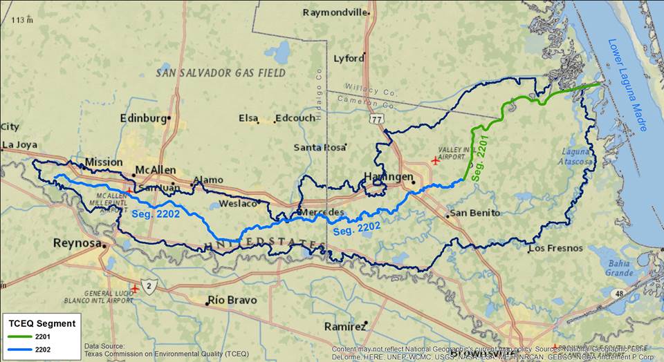
During stakeholder meetings for the 2017 Update to the Arroyo Colorado WPP, the accuracy of the watershed boundary used in the WPP was questioned. This boundary was delineated using digital elevation models (topography) available at the time. As a result, the partnership discussed and included in the WPP (pg 87) a management recommendation to update the watershed boundary through further detailed studies.
Project Overview
This project will focus on 1) continued tracking of management measures implemented and identified in the updated Arroyo Colorado Watershed Protection Plan (WPP), 2) assess the watershed boundary and adjust its extent to reflect local topography and hydrologically modified conditions, and 3) continue updating the watershed OSSF inventory in the geodatabase.
- The Texas Water Resources Institute (TWRI) is continuing to implement the WPP and track its implementation and its management measures. It is also providing technical assistance to the partnership and community stakeholders and will collect data on WPP implementation efforts.
- To start off, high-precision digital elevation data will be acquired by TWRI to generate a draft updated watershed boundary map. Stakeholder input will be sought to refine the boundary of the draft map based on local knowledge. Draft updates to the layer will be presented at future partnership meetings to allow for additional feedback. If you are interested in providing input to the boundary refinement, please email Samantha Colunga at samantha.colunga@ag.tamu.edu.
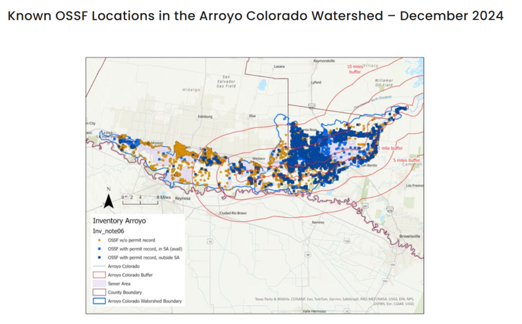
- AgriLife will update the inventory of OSSF systems in Hidalgo County, Cameron County and within the Cameron County Coastal Zone as new OSSFs are installed or replaced in the project area. Summary information will be generated and maps will be produced. The project will also develop a map highlighting the OSSFs within the critical zone of one, three, and five miles of the Arroyo Colorado and have a higher risk potential of polluting the Arroyo Colorado should they fail. This map will be used to prioritize the OSSFs located in the critical zone for inspection and repair or replacement in future projects.
Watershed and OSSF educational materials and outreach programs specifically targeting homeowners are being developed. Visit the Septic System Resources page.
Project Reports
- No reports as of 8/27/26